- This event has passed.
Genesee Valley Pathfinders – GENESEE RIVER CHALLENGE
September 21, 2024 at 9:00 am - September 22, 2024 at 9:00 pm

Welcome to the inaugural GENESEE RIVER CHALLENGE!
Have you ever wanted to bicycle the entire length of the Nile of Western NY – from its headwaters in Gold Pennsylvania to its final resting point at Lake Ontario? Have you got a whole weekend in September to dedicate to your passion for endurance activities and our muddy mother river? Do you know someone that can give you and 3 of your closest friends a ride to Pennsylvania with your bikes? Then THIS is the ride for you!
THE CHALLENGE RULES:
– Make the Grand Depart, 9am at the Triple Divide marker
– Cycle the entirety of the route within 32 hours (9pm Sunday)
– Your journey must be self-supported
– You can resupply water and food en-route (duh)
– You can choose to ride in groups or teams if desired, and helping fellow riders is encouraged.
– Everyone who completes the challenge will receive a prize, along with the best time.
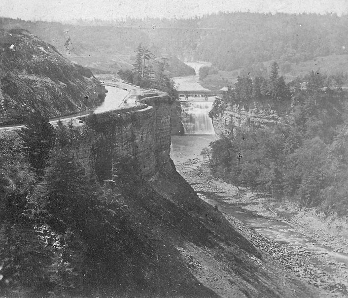
Based very loosely on the Triple Divide Trail Ride, the route takes you along the punchy dirt climbs at its headwaters in PA to the Rochester Harbor Light at Charlotte Pier. This challenge is the ultimate way to see the entirety of the Genesee Valley from start to finish. Enjoy stumbling upon historic steel bridges, scenic gorges and vistas, the Mt. Morris Dam, and the beautiful transition from rolling hills to marshy farm lands as you ride across New York State.
I’ll be working out some final route details in the upcoming weeks, along with the logistics of getting us and all of our stuff out to Pennsylvania – details to come.
DISTANCE: 150miles
ELEVATION: 4,600′ (net downhill the whole ride)
ROUTE: https://ridewithgps.com/routes/44259448
.GPX: https://drive.google.com/…/180BOkxUaZYKTh1uPawO…/view…
ELEVATION: 4,600′ (net downhill the whole ride)
ROUTE: https://ridewithgps.com/routes/44259448
.GPX: https://drive.google.com/…/180BOkxUaZYKTh1uPawO…/view…
Tidbits:
– This is a road/touring/gravel ride, whatever those mean to you
– This is a road/touring/gravel ride, whatever those mean to you
– Bring ample food/snacks/hydration for the first leg, it’s very rural until you get to Wellsville
– One strategy is to try to go steadily the entire 150 miles with minimal stopping, relying mainly on prepacked food/water and frequent short stops to stretch and refuel. These people will travel light and not bring any camping gear, and stand the best chance at a FKT. With an average speed of 10mph, you could complete the challenge by roughly midnight Saturday.
– Another strategy is to enjoy the duration of the challenge by not focusing on the 32 hour time limit because it’s a LOT of time, and instead focus on seeing the most of the route. These people will likely camp overnight somewhere near Letchworth State Park, which has ample opportunity to camp in and around it. If you can make the 80 miles to Letchworth state park on Saturday and get a good nights rest – the remaining 60 miles on Sunday should be a piece of cake if you leave camp by 9am the next morning.
– There are two Lean to shelters of the Finger Lakes Trail on the East side of Letchworth State Park that can be camped in, with picnic tables, benches, and fire pits/grills. The lands on that side can also be free-camped on, so it’s a lot of open space to camp in for those looking to make the attempt over two days.
